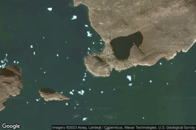
helipuertos en Groenlandia.
#1 helipuerto Niaqornat a Niaqornat (Groenlandia) BGNT NIQ
Altitud : 3 m = 10ft
helipuerto Niaqornat se encuentra cerca de Niaqornat, Qaarsut a 38 km↑, Uummannaq a 58 km↑, Qeqertarsuaq a 172 km↑, Qaasuitsup a 200 km↑, Ilulissat a 200 km↑, Aasiaat a 233 km↑,
-> tiempo de aviación para el aeropuerto del Niaqornat
#2 helipuerto Paamiut a Paamiut (Groenlandia) BGFHaeropuerto desaparecido
Altitud : 19 m = 62ft
helipuerto Paamiut se encuentra cerca de Paamiut, Paamiut a 0.3 km↑, Ivittuut a 118 km↑, Kangilinnguit a 119 km↑, Narsaq a 226 km↑, Kujalleq a 240 km↑, Qaqortoq a 240 km↑,
-> tiempo de aviación para el aeropuerto del Paamiut
#3 helipuerto Nuussuaq a Nuussuaq (Groenlandia) BGNU NSQ NUS
Altitud : 56 m = 184ft
helipuerto Nuussuaq se encuentra cerca de Nuussuaq, Upernavik a 150 km↑, Qaarsut a 403 km↑, Uummannaq a 416 km↑, Dundas a 426 km↑, Qaanaaq a 501 km↑, Qeqertarsuaq a 554 km↑,
-> tiempo de aviación para el aeropuerto del Nuussuaq
#4 helipuerto Saattut a Saattut (Groenlandia) BGST SAE
Altitud : 40 m = 131ft
helipuerto Saattut se encuentra cerca de Saattut, Uummannaq a 24 km↑, Qaarsut a 38 km↑, Qaasuitsup a 178 km↑, Ilulissat a 178 km↑, Qeqertarsuaq a 188 km↑, Qasigiannguit a 222 km↑,
-> tiempo de aviación para el aeropuerto del Saattut
#5 helipuerto Illorsuit a Illorsuit (Groenlandia) BGLL IOT
Altitud : 47 m = 154ft
helipuerto Illorsuit se encuentra cerca de Illorsuit, Qaarsut a 66 km↑, Uummannaq a 82 km↑, Upernavik a 193 km↑, Qeqertarsuaq a 222 km↑, Qaasuitsup a 243 km↑, Ilulissat a 243 km↑,
-> tiempo de aviación para el aeropuerto del Illorsuit
#6 helipuerto Aappilattoq a Aappilattoq (Groenlandia) BGAG AOQ
Altitud : 13 m = 43ft
helipuerto Aappilattoq se encuentra cerca de Aappilattoq, Upernavik a 21 km↑, Qaarsut a 260 km↑, Uummannaq a 274 km↑, Qeqertarsuaq a 411 km↑, Qaasuitsup a 439 km↑, Ilulissat a 439 km↑,
-> tiempo de aviación para el aeropuerto del Aappilattoq
#7 helipuerto Ikerassaarsuk a Ikerassaarsuk (Groenlandia) BGIK QRY
Altitud : 50 m = 164ft
helipuerto Ikerassaarsuk se encuentra cerca de Ikerassaarsuk, Kangaatsiaq a 18 km↑, Aasiaat a 67 km↑, Nivaaq a 68 km↑, Qasigiannguit a 119 km↑, Qeqertarsuaq a 123 km↑, Sisimiut a 134 km↑,
-> tiempo de aviación para el aeropuerto del Ikerassaarsuk
#8 helipuerto Ammassivik a Ammassivik (Groenlandia) BGAS
Altitud : 22 m = 72ft
helipuerto Ammassivik se encuentra cerca de Ammassivik, Qaqortoq a 38 km↑, Kujalleq a 38 km↑, Narsaq a 51 km↑, Nanortalik a 51 km↑, Narsarsuaq a 64 km↑, Kangilinnguit a 162 km↑,
-> tiempo de aviación para el aeropuerto del Ammassivik
#9 helipuerto Moriusaq a Moriusaq (Groenlandia) BGMO MOR
Altitud : 13 m = 43ft
helipuerto Moriusaq se encuentra cerca de Moriusaq, Dundas a 35 km↑, Qaanaaq a 82 km↑, Pond Inlet a 508 km↑, Upernavik a 593 km↑, Arctic Bay a 603 km↑, Clyde River a 700 km↑,
-> tiempo de aviación para el aeropuerto del Moriusaq
#10 helipuerto Station Nord a Station Nord (Groenlandia) BGNO
Altitud : 88 m = 289ft
helipuerto Station Nord se encuentra cerca de Station Nord, Longyearbyen a 739 km↑, Nybyen a 740 km↑, Svalbard a 748 km↑, Spitsbergen a 785 km↑, Qaanaaq a 1088 km↑, Dundas a 1158 km↑,
-> tiempo de aviación para el aeropuerto del Station Nord
#11 helipuerto Kangersuatsiaq a Kangersuatsiaq (Groenlandia) BGKS KGQ
#12 helipuerto Tasiusaq a Tasiusaq (Groenlandia) BGTA TQA
#13 helipuerto Savissivik a Savissivik (Groenlandia) BGSV SVR
#14 helipuerto Ikerasassuaq a Ikerasassuaq (Groenlandia) BGPC
#15 helipuerto Qassimiut a Qassimiut (Groenlandia) BGQT
#16 helipuerto Innarsuit a Innarsuit (Groenlandia) BGIN IUI INN
#17 helipuerto Akunnaaq a Akunnaaq (Groenlandia) QCU GL-QCU
#18 helipuerto Qeqertarsuaq a Qeqertarsuaq (Groenlandia) BGGN JGO
#19 helipuerto Ilimanaq a Ilimanaq (Groenlandia) BGIL XIQ
#20 helipuerto Ittoqqortoormiit a Ittoqqortoormiit (Groenlandia) BGSC OBY
#21 helipuerto Aappilattoq a Aappilattoq (Groenlandia) BGAQ
#22 helipuerto Tasiilaq a Tasiilaq (Groenlandia) BGAM AGM AGM
#23 helipuerto Iginniarfik a Iginniarfik (Groenlandia) GL-QFI
#24 helipuerto Qeqertaq a Qeqertaq (Groenlandia) BGQE PQT QQT
#25 helipuerto Arsuk a Arsuk (Groenlandia) BGAR
#26 helipuerto Narsarmijit a Narsarmijit (Groenlandia) BGFD
#27 helipuerto Alluitsup Paa a Alluitsup Paa (Groenlandia) BGAP
#28 helipuerto Siorapaluk a Siorapaluk (Groenlandia) BGSI SRK
#29 helipuerto Tiniteqilaaq a Tiniteqilaaq (Groenlandia) BGTN TQI
#30 helipuerto Qasigiannguit a Qasigiannguit (Groenlandia) BGCH JCH
#31 helipuerto Kangaatsiaq a Kangaatsiaq (Groenlandia) BGKA QPW
#32 helipuerto Ikamiut a Ikamiut (Groenlandia) BGIT QJI
#33 helipuerto Grønnedal a Kangilinnguit (Groenlandia) GL-JGRaeropuerto desaparecido
#34 helipuerto Igaliku a Igaliku (Groenlandia) QFX
#35 helipuerto Attu a Attu (Groenlandia) BGAT QGQ
#36 helipuerto Qaqortoq a Qaqortoq (Groenlandia) BGJH JJU
#37 helipuerto Kuummiut a Kuummiut (Groenlandia) BGKM KUZ KMT
#38 helipuerto Kangilinnguit a Kangilinnguit (Groenlandia) BGGD
#39 helipuerto Saqqaq a Saqqaq (Groenlandia) BGSQ QUP
#40 helipuerto Isortoq a Isortoq (Groenlandia) BGIS IOQ ISO
#41 helipuerto Kitsissuarsuit a Kitsissuarsuit (Groenlandia) BGKT QJE
#42 helipuerto Nanortalik a Nanortalik (Groenlandia) BGNN JNN
#43 helipuerto Eqalugaarsuit a Eqalugaarsuit (Groenlandia) BGET QFG
#44 helipuerto Saarloq a Saarloq (Groenlandia) BGSO QOQ
#45 helipuerto Kullorsuaq a Kullorsuaq (Groenlandia) BGKQ KHQ
#46 helipuerto Ukkusissat a Ukkusissat (Groenlandia) BGUT JUK
#47 helipuerto Ikerasak a Ikerasak (Groenlandia) BGIA IKE
#48 helipuerto Upernavik Kujalleq a Upernavik Kujalleq (Groenlandia) BGKL UPK
#49 helipuerto Daneborg a Daneborg (Groenlandia) BGDB
#50 helipuerto Nalunaq a Nalunaq (Groenlandia) BGNL
#51 helipuerto Tasiusaq a Tasiusak (Groenlandia) BGTQ
#52 helipuerto Uummannaq a Uummannaq (Groenlandia) BGUM UMD
#53 helipuerto Niaqornaarsuk a Niaqornaarsuk (Groenlandia) BGNK
#54 helipuerto Sermiligaaq a Sermiligaaq (Groenlandia) BGSG SMG
#55 helipuerto Nuugaatsiaq a Nuugaatsiaq (Groenlandia) BGNQ JUU NUG
#56 helipuerto Narsaq a Narsaq (Groenlandia) BGNS JNS
Fuentes de datos
- AVWX (avwx.rest)
- Vista aérea : Google Maps (www.google.com), Microsoft Bing (www.microsoft.com) ou OpenStreetMap (www.openstreetmap.org)


