Airport information, from map to hotels via aeronautical information. And the aeronautical weather for the pilots with current weather and short-term forecasts with METAR (METeorological Aerodrome Report, observation message of meteorological conditions for aviation) and TAF (Terminal Aerodrome Forecast: short-term forecast message of meteorological conditions for aviation ). And other resources such as VAC (Visual Approach Chart) to prepare flights.
St. Athan airport (RAF St Athan) in St. Athan Cardiff (United Kingdom)
St. Athan airport also known asRAF St Athanis located near St. Athan, Cardiff, with Vale of Glamorgan at 1mi↑, Llantwit Major at 2mi↑, Penmark at 3mi↑, Rhoose at 4mi↑, Cowbridge at 4mi↑, Penllyn at 5mi↑, Ystradowen at 6mi↑, Llangan at 6mi↑,
→ See also Northernmost airports in United Kingdom and Southernmost airports in United Kingdom
→ See also airports in United Kingdom
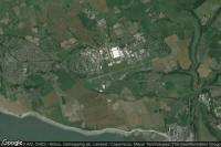
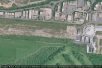
aerial view of St. Athan airport
Airport code
- ICAO code : EGSY
- IATA code : -
- Local code : -
Elevation : 50 m = 164ft
→ See also Highest airports in UK and Lowest airports in United Kingdom
Runways
- runway 10/28 : 1211m = 3973ft
→ See also Airports with Longest runways in United Kingdom
Coming to St. Athan airport
Taxi : book on Taxi Booking
Rent a car : book on Rentalcars
By train : book on Trip.com
- Barry Station train station at 7mi
- Barry Island train station at 7mi
- Barry Docks train station at 8mi
By plane :
- Cardiff International airport at 4mi : book on Trip.com
- Swansea airport at 31mi : book on Trip.com
- Bristol airport at 31mi : book on Trip.com
Aviation weather for St. Athan airport EGSY
METAR for St. Athan airport EGSY
EGSY 092150Z AUTO 09005KT 9999 NCD 11/05 Q1019
Decoded METAR for St. Athan airport EGSY
METAR issued by EGSY on Friday, May 9, 2025 at 21:50 UTC. This is an automatically generated METAR, Warning : this METAR is out of date, issued 1 days and 42 hours and -1399 minutes ago.
visibility is greater than 10km = greater than 6mi.
The temperature is 11°C = 52°F, dew point is 5°C = 41°F. The air is very humid : relative air humidity is 67 %.
QNH is 1019hPa = 30.09inHg
Wind 9km/h = 5kt, direction is 90°.
Sky clear.
TAF for St. Athan airport EGSY
EGSY 091957Z 0921/1006 09007KT CAVOK
Decoded TAF for St. Athan airport EGSY
TAF issued by EGSY on Friday, May 9, 2025 at 19:57 UTC Warning : this TAF is out of date, issued 1 days and 20 hours and 34 minutes. weather forecast for 9 hours, weather forecast updated every 3 hours.
from Friday, May 9, 2025 à 21:00 heure TU to Saturday, May 10, 2025 à 06:00 heure UTC
0921/1006 09007KT CAVOK
CAVOK = Ceiling And Visibility OK, visibility is more than 10 km, no clouds below 5000 ft or below the minimum sector altitude. No cumulonimbus or budding cumulus, regardless of their altitude and no Significant Weather
wind 7kt = 13km/h, direction is 90°
Visibility is greater than 10km = greater than 6mi.
NOTAM for St. Athan airport
Around St. Athan airport (RAF St Athan) in St. Athan Cardiff (United Kingdom)
near
- Hotels in Vale of Glamorgan
- Le Matissia (Paris) at 310mi↑
- Paris at 311mi↑
- Hotel Monge (Paris) at 311mi↑
- Cité du Vin (Bordeaux) at 471mi↑
- Hôtel de Tourny (Bordeaux) at 472mi↑
- Bordeaux at 472mi↑
- Hôtel Cardinal (Bordeaux) at 472mi↑
- Station de montagne Cap Guéry at 491mi↑
- Station de montagne Pessade at 492mi↑
- Station de montagne Chastreix Sancy at 495mi↑
- Station de montagne Le Mont Dore at 495mi↑
- Station de montagne Super Besse at 499mi↑
- for St. Athan airport at 0mi↑
- for RAF Llandow Air Base airport at 3mi↑
- for Cardiff International airport at 4mi↑
nearest airports to St. Athan airport (RAF St Athan) in St. Athan Cardiff (United Kingdom)
- RAF Llandow Air Base airport ( GB-0173) at 3mi↑defunct airport
- Cardiff International airport (EGFF CWL ) at 4mi↑METAR TAF NOTAM
- Royal Glamorgan Hospital heliport ( GB-0631) at 10mi↑
- Cardiff heliport (EGFC ) at 14mi↑NOTAM
- ST ATHAN RAF airport (EGDX ) at 14mi↑NOTAM
- Old Park Farm Airstrip airport ( GB-0035) at 16mi↑
- Brookside Farm Private Airstrip airport ( GB-0857) at 16mi↑
- Croes-Carn-Einion Farm airport ( GB-0928) at 19mi↑
- Batch End Farm Airstrip airport ( GB-0886) at 22mi↑
- Weston-super-Mare heliport ( GB-0515) at 22mi↑
- Glebe Farm Airstrip airport ( GB-1012) at 23mi↑
- Rhigos Airstrip airport ( GB-0912) at 24mi↑
→ See also Former airports in United Kingdom
Data sources
- Infos générales : AVWX, France FFPLUM
- METAR : AVWX
- TAF : AVWX
- Météo générale : Openweathermap et AVWX
- NOTAM : FAA
- VAC : France DGAC/SIA, Espagne ENAIRE, Belgique SKEYES
- Aerial maps : Google Maps, Microsoft Bing ou OpenStreetMap