Former airports, eaten away by urbanization or transformed into giant car parks. List of these places where planes landed. in Chile.
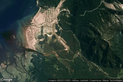
#1 Chaitén airport at Chaiten (Chile)defunct airport
Altitude : 4 m = 13ft
Chaitén airport is located close to Chaiten, Chaiten at 2 km↑, Queilén at 63 km↑, Futaleufu at 74 km↑, Quellón at 75 km↑, Puerto Quellon at 77 km↑, Achao at 85 km↑,
The longest runway measure : 1423 m = 4669ft
- runway 13/31 : 1423m = 4669ft
-> Aviation weather for Chaitén airport
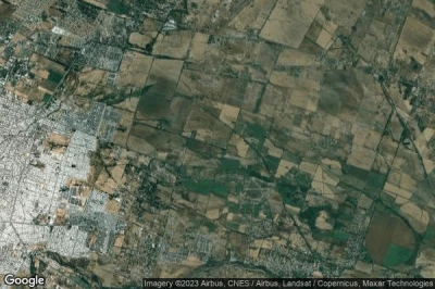
#2 Mónaco airport at Paine (Chile) SCMN SCMNdefunct airport
Altitude : 145 m = 476ft
Mónaco airport is located close to Paine, La Estrella at 29 km↑, El Manzano at 53 km↑, Las Cabras at 61 km↑, Pichidegua at 62 km↑, Capellanía at 69 km↑, Santa Cruz at 69 km↑,
The longest runway measure : 650 m = 2133ft
- runway 14/32 : 650m = 2133ft
- runway 03/21 : 462m = 1516ft
-> Aviation weather for Mónaco airport
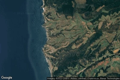
#3 Bahia Catalina airport at Punta Arenas (Chile) CL-0001defunct airport
Altitude : 9 m = 30ft
Bahia Catalina airport is located close to Punta Arenas, Punta Arenas at 3.7 km↑, Río de los Ciervos at 7.1 km↑, Chabunco at 13 km↑, Porvenir at 38 km↑, Region of Magallanes at 159 km↑, Puerto Natales at 191 km↑,
-> Aviation weather for Bahia Catalina airport
#4 La Vertiente airport at Chillan (Chile) SCAVdefunct airport
Altitude : 140 m = 459ft
La Vertiente airport is located close to Chillan, General Lagos Guindos at 3 km↑, Chillan at 5.8 km↑, Coihueco at 18 km↑, San Ignacio at 21 km↑, San Carlos at 22 km↑, Bulnes at 27 km↑,
The longest runway measure : 720 m = 2362ft
- runway 10/28 : 720m = 2362ft
-> Aviation weather for La Vertiente airport
#5 San Alfonso airport at Alhue (Chile) SCAFdefunct airport
Altitude : 124 m = 407ft
San Alfonso airport is located close to Alhue, Villa Alhué at 13 km↑, El Manzano at 21 km↑, Las Cabras at 27 km↑, Coltauco at 30 km↑, Doñihue at 32 km↑, Pichidegua at 33 km↑,
The longest runway measure : 700 m = 2297ft
- runway 7/25 : 700m = 2297ft
-> Aviation weather for San Alfonso airport
#6 Casablanca El Porvenir airport at Osorno (Chile) SCCPdefunct airport
Altitude : 115 m = 377ft
Casablanca El Porvenir airport is located close to Osorno, Pichil at 18 km↑, El Crucero at 23 km↑, Osorno at 26 km↑, San Pablo at 28 km↑, Rio Bueno at 35 km↑, Río Negro at 37 km↑,
-> Aviation weather for Casablanca El Porvenir airport
#7 Kimiri Ayke airport at San Gregorio (Chile) CL-0003defunct airport
Altitude : 26 m = 85ft
Kimiri Ayke airport is located close to San Gregorio, Rio Gallegos at 93 km↑, Hill Station at 98 km↑, Chabunco at 102 km↑, Porvenir at 109 km↑, Punta Arenas at 116 km↑, Río de los Ciervos at 120 km↑,
-> Aviation weather for Kimiri Ayke airport
#8 María Elena airport at Maria Elena (Chile) SCNEdefunct airport
Altitude : 1220 m = 4003ft
María Elena airport is located close to Maria Elena, Oficina María Elena at 6.2 km↑, Tocopilla at 56 km↑, Chuquicamata at 79 km↑, Calama at 81 km↑, Mejillones at 117 km↑, La Portada at 153 km↑,
The longest runway measure : 1720 m = 5643ft
- runway 6/24 : 1720m = 5643ft
-> Aviation weather for María Elena airport
#9 Panimavida airport at Panimavida (Chile) SCIVdefunct airport
Altitude : 180 m = 591ft
Panimavida airport is located close to Panimavida, Colbún Alto at 17 km↑, Linares at 20 km↑, San Clemente at 24 km↑, Villa Alegre at 33 km↑, Longavi at 34 km↑, San Javier at 36 km↑,
-> Aviation weather for Panimavida airport
#10 LOS CERRILLOS airport at (Chile) SCTIdefunct airport
Altitude : 511 m = 1677ft
LOS CERRILLOS airport is located close to La Ermita at 9.8 km↑, Villa Paulina at 11 km↑, Lo Barnechea at 12 km↑, Las Condes at 13 km↑, Farellones at 16 km↑, Vitacura at 21 km↑,
-> Aviation weather for LOS CERRILLOS airport
#11 Campo Cerro Manantiales airport at Primavera (Chile) CL-0009defunct airport
#12 La Chimba airport at La Chimba (Chile) SCMBdefunct airport
#13 Gente Grande airport at Porvenir (Chile) CL-0002defunct airport
#14 Sandra Scabini airport at Punta Arenas (Chile) SCNSdefunct airport
#15 Papageno airport at Panguipulli (Chile) SCNGdefunct airport
#16 Fundo Naicura airport at Rengo (Chile) SCNRdefunct airport
#17 Curaco airport at Panguipulli (Chile) SCGPdefunct airport
#18 Marimenuco airport at Lonquimay (Chile) CL-0011defunct airport
Data sources
- AVWX (avwx.rest)
- Aerial maps : Google Maps (www.google.com), Microsoft Bing (www.microsoft.com) ou OpenStreetMap (www.openstreetmap.org)


