Airport information, from map to hotels via aeronautical information. And the aeronautical weather for the pilots with current weather and short-term forecasts with METAR (METeorological Aerodrome Report, observation message of meteorological conditions for aviation) and TAF (Terminal Aerodrome Forecast: short-term forecast message of meteorological conditions for aviation ). And other resources such as VAC (Visual Approach Chart) to prepare flights.
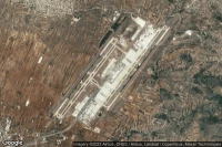
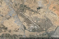
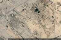
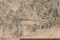
Shiraz (Iran)
Shiraz Shahid Dastghaib International airport aviation weather and facilities (OISS SYZ )
Toluca (Mexico)
Licenciado Adolfo Lopez Mateos International airport aviation weather and facilities (MMTO TLC )
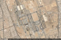
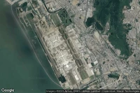
Abu Dhabi (United Arab Emirates)
Zayed International airport aviation weather and facilities (OMAA AUH )

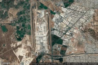
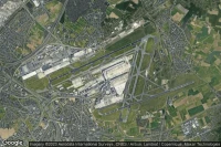
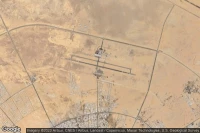
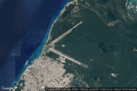
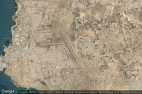
Medina (Saudi Arabia)
Prince Mohammad Bin Abdulaziz airport aviation weather and facilities (OEMA MED )

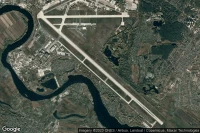
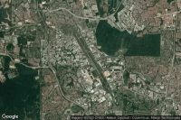
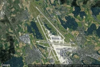
Athens (Greece)
Eleftherios Venizelos International airport aviation weather and facilities (LGAV ATH )
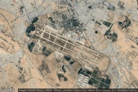
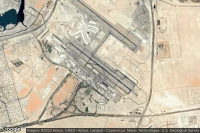
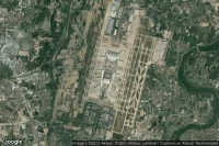
Jeddah (Saudi Arabia)
King Abdulaziz International airport aviation weather and facilities (OEJN JED )
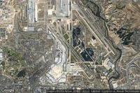
Mexico City (Mexico)
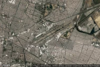
Licenciado Benito Juarez International airport aviation weather and facilities (MMMX MEX )


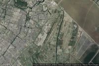
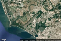
Subang (Malaysia)
Sultan Abdul Aziz Shah International airport aviation weather and facilities (WMSA SZB )
Santiago (Chile)
Comodoro Arturo Merino Benítez International airport aviation weather and facilities (SCEL SCL )
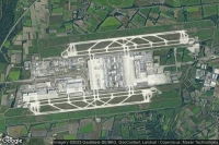
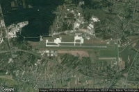
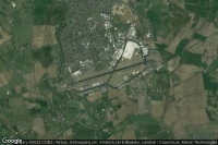
Budapest (Hungary)
Budapest Liszt Ferenc International airport aviation weather and facilities (LHBP BUD )

Jiaozhou, Qingdao (China)

Qingdao Jiaodong International airport aviation weather and facilities (ZSQD TAO )


Rio Gallegos (Argentina)

Rio Gallegos Piloto Civil Norberto Fernández International airport aviation weather and facilities (SAWG RGL )
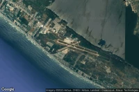
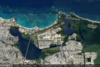
Pointe-à-Pitre (Guadeloupe)
Pointe-à-Pitre Le Raizet airport aviation weather and facilities (TFFR PTP )
Varadero (Cuba)
Juan Gualberto Gomez International airport aviation weather and facilities (MUVR VRA )
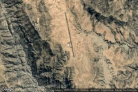
San Miguel de Tucumán (Argentina)
Teniente Benjamin Matienzo airport aviation weather and facilities (SANT TUC )

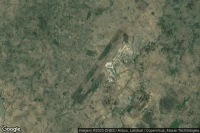
Puerto Maldonado (Peru)
Padre Aldamiz International airport aviation weather and facilities (SPTU PEM )
Zandery (Suriname)

Johan Adolf Pengel International airport aviation weather and facilities (SMJP PBM )
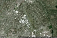
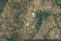
Shijiazhuang (China)
Shijiazhuang Daguocun International airport aviation weather and facilities (ZBSJ SJW )
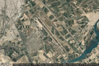
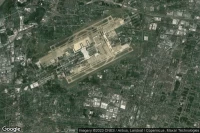
Zhengzhou (China)
Zhengzhou Xinzheng International airport aviation weather and facilities (ZHCC CGO )

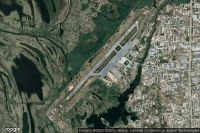
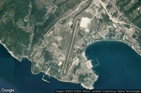
Kailua Kona (United State)
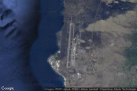
Ellison Onizuka Kona International At Keahole airport aviation weather and facilities (PHKO KOA )
Acapulco (Mexico)
General Juan N Alvarez International airport aviation weather and facilities (MMAA ACA )
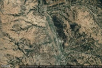
Puerto Iguazu (Argentina)
Cataratas Del Iguazú International airport aviation weather and facilities (SARI IGR )


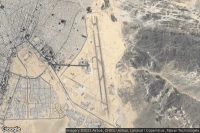
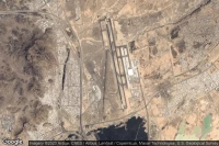
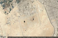
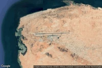
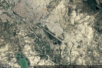
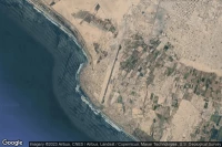
Yanbu (Saudi Arabia)
Prince Abdulmohsin Bin Abdulaziz airport aviation weather and facilities (OEYN YNB )


Puerto Vallarta (Mexico)
Licenciado Gustavo Díaz Ordaz International airport aviation weather and facilities (MMPR PVR )


San Juan (Puerto Rico)
Luis Munoz Marin International airport aviation weather and facilities (TJSJ SJU )
Trujillo (Peru)
Capitan FAP Carlos Martinez De Pinillos International airport aviation weather and facilities (SPRU TRU )
Salvador (Brazil)

Deputado Luiz Eduardo Magalhães International airport aviation weather and facilities (SBSV SSA )

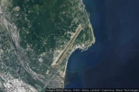
Natal (Brazil)
Governador Aluízio Alves International airport aviation weather and facilities (SBSG NAT )
Belo Horizonte (Brazil)
Tancredo Neves International airport aviation weather and facilities (SBCF CNF )
Barranquilla (Colombia)
Ernesto Cortissoz International airport aviation weather and facilities (SKBQ BAQ )
Barahona (Dominican Republic)
Maria Montez International airport aviation weather and facilities (MDBH BRX )
Data sources
- Infos générales : AVWX, France FFPLUM
- METAR : AVWX
- TAF : AVWX
- Météo générale : Openweathermap et AVWX
- NOTAM : FAA
- VAC : France DGAC/SIA, Espagne ENAIRE, Belgique SKEYES
- Aerial maps : Google Maps, Microsoft Bing ou OpenStreetMap