Airport information, from map to hotels via aeronautical information. And the aeronautical weather for the pilots with current weather and short-term forecasts with METAR (METeorological Aerodrome Report, observation message of meteorological conditions for aviation) and TAF (Terminal Aerodrome Forecast: short-term forecast message of meteorological conditions for aviation ). And other resources such as VAC (Visual Approach Chart) to prepare flights.


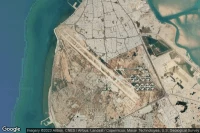
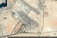
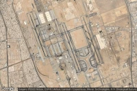
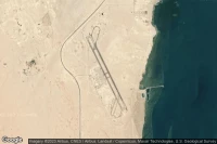
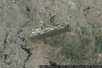
Jebel Ali Dubai (United Arab Emirates)
Al Maktoum International airport aviation weather and facilities (OMDW DWC )

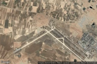
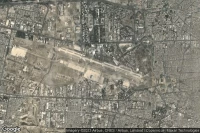
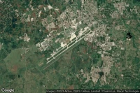
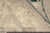
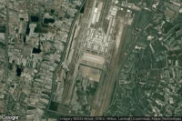
Isfahan (Iran)
Esfahan Shahid Beheshti International airport aviation weather and facilities (OIFM IFN )
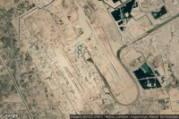
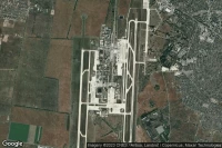
Shiraz (Iran)
Shiraz Shahid Dastghaib International airport aviation weather and facilities (OISS SYZ )
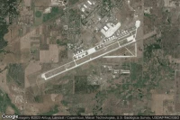
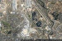
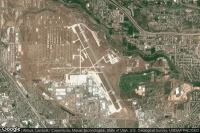
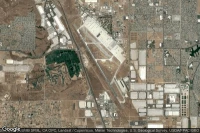
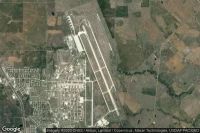
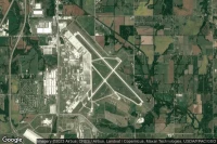
Albuquerque (United State)
Albuquerque International Sunport airport aviation weather and facilities (KABQ ABQ )

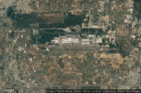
Tucson (United State)
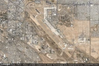
Davis Monthan Air Force Base airport aviation weather and facilities (KDMA DMA )

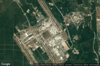
Fort Bliss El Paso (United State)

Biggs Army Air Field (Fort Bliss) airport aviation weather and facilities (KBIF BIF )
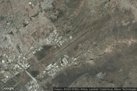
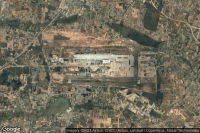
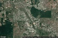
Kuala Lumpur (Malaysia)
Kuala Lumpur International airport aviation weather and facilities (WMKK KUL )
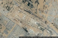
Mountain Home (United State)
Mountain Home Air Force Base airport aviation weather and facilities (KMUO MUO )
Amarillo (United State)
Rick Husband Amarillo International airport aviation weather and facilities (KAMA AMA )
Rapid City (United State)

Ellsworth Air Force Base airport aviation weather and facilities (KRCA RCA )
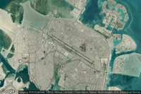
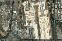
Abu Dhabi (United Arab Emirates)
Zayed International airport aviation weather and facilities (OMAA AUH )


Batam Island (Indonesia)
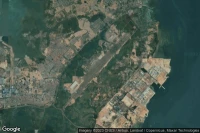
Hang Nadim International airport aviation weather and facilities (WIDD BTH )

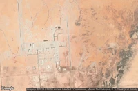
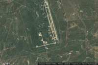
Louis Trichardt Southwest (South Africa)
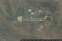
Makhado Air Force Base airport aviation weather and facilities (FALM )
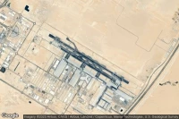
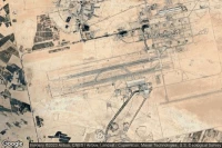
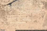
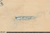
Medina (Saudi Arabia)
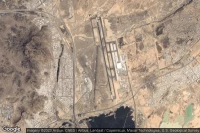
Prince Mohammad Bin Abdulaziz airport aviation weather and facilities (OEMA MED )

Rio De Janeiro (Brazil)
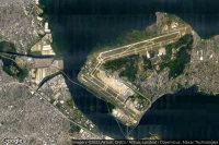
Rio Galeão – Tom Jobim International airport aviation weather and facilities (SBGL GIG )
Gaborone (Botswana)
Sir Seretse Khama International airport aviation weather and facilities (FBSK GBE )
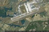

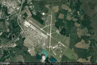
Luxembourg (Luxembourg)
Luxembourg-Findel International airport aviation weather and facilities (ELLX LUX )


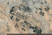
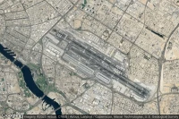
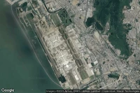
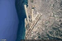
Jeddah (Saudi Arabia)
King Abdulaziz International airport aviation weather and facilities (OEJN JED )
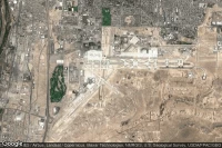
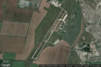
Wichita Falls (United State)
Sheppard Air Force Base-Wichita Falls Municipal airport aviation weather and facilities (KSPS SPS )
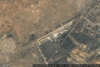
Hoedspruit (South Africa)
Hoedspruit Air Force Base airport aviation weather and facilities (FAHS HDS )
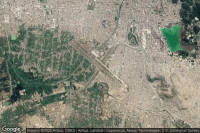
Mexico City (Mexico)
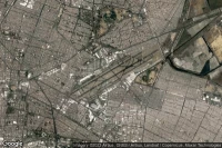
Licenciado Benito Juarez International airport aviation weather and facilities (MMMX MEX )
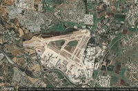
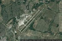
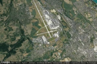
Milan (Italy)
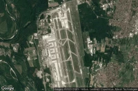
Milan Malpensa international Silvio Berlusconi airport aviation weather and facilities (LIMC MXP )
Topeka (United State)
Topeka Regional - Forbes Field airport aviation weather and facilities (KFOE FOE )
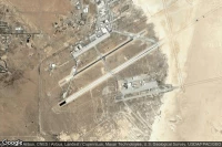
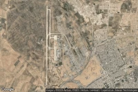
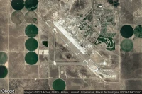
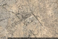
Alamogordo (United State)
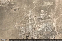
Holloman Air Force Base airport aviation weather and facilities (KHMN HMN )
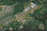
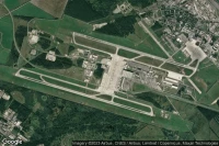
Bâle Mulhouse Fribourg (France)
EuroAirport Basel-Mulhouse-Freiburg airport aviation weather and facilities (LFSB BSL )

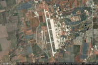
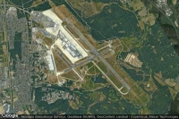
Dayton (United State)
Wright-Patterson Air Force Base airport aviation weather and facilities (KFFO FFO )


Addis Ababa (Ethiopia)
Addis Ababa Bole International airport aviation weather and facilities (HAAB ADD )
Beirut (Lebanon)
Beirut Rafic Hariri International airport aviation weather and facilities (OLBA BEY )

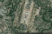
Ho Chi Minh City (Viet Nam)
Tan Son Nhat International airport aviation weather and facilities (VVTS SGN )
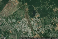
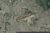
Cochabamba (Bolivia)
Jorge Wilsterman International airport aviation weather and facilities (SLCB CBB )
Subang (Malaysia)
Sultan Abdul Aziz Shah International airport aviation weather and facilities (WMSA SZB )

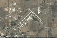
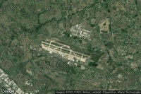
Knob Noster (United State)
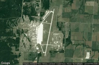
Whiteman Air Force Base airport aviation weather and facilities (KSZL SZL )
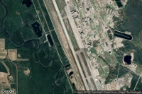
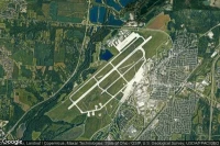
Grand Forks (United State)
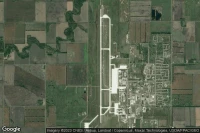
Grand Forks Air Force Base airport aviation weather and facilities (KRDR RDR )
Data sources
- Infos générales : AVWX, France FFPLUM
- METAR : AVWX
- TAF : AVWX
- Météo générale : Openweathermap et AVWX
- NOTAM : FAA
- VAC : France DGAC/SIA, Espagne ENAIRE, Belgique SKEYES
- Aerial maps : Google Maps, Microsoft Bing ou OpenStreetMap