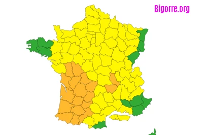
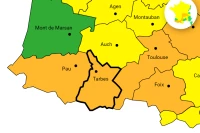
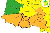
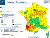
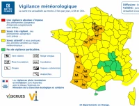
Météo-France is announcing a rainstorm episode requiring special vigilance as there is a high risk of violent events
The sky is overcast and rainy in the Nouvelle-Aquitaine region. On the Spanish side, thunderstorms are beginning to develop and move up towards the Pyrenees. On the Haute-Loire plateaus, the southerly wind is already blowing strongly, with gusts exceeding 100 km/h in the Puy-de-Vallée region and at the summit of Pilat.
Early this afternoon, thunderstorms are expected in the southwest of Nouvelle-Aquitaine, in the Gers and Hautes-Pyrénées regions before moving north and east, particularly towards Tarn-et-Garonne, Lot, and Limousin. They will affect the rest of the Midi-Pyrénées region later. These first thunderstorms are mainly electrically charged but will be accompanied by light to moderate showers and gusts between 60 and 70 km/h.
Hail and strong winds forecast for the late afternoon
But the orange alert is warranted by the following events, with a rain and thunderstorm system developing in the late afternoon and hitting the coastal departments. It will generate strong thunderstorms that will quickly progress towards eastern Aquitaine, Charente, Gers, and the Hautes-Pyrénées, before reaching Poitou, western Occitanie, and Limousin
. Météo-France predicts these storms will be violent, with violent wind gusts reaching 80 to 100 km/h locally, plus strong electrical activity, hail, and locally heavy rainfall totals reaching 15 to 30 mm per hour. It will take until the evening or the middle of the night for the phenomenon to subside, with a few weaker thunderstorms possibly persisting before a gradual return to calm.
The southerly wind will strengthen, and gusts will often exceed 100 km/h from the Haute-Loire plateaus to the south of the Loire department
. Biarritz airport is forecasting gusts of 80 km/h between 6 p.m. and 8 p.m. The same is forecast for Bordeaux between 7 p.m. and 10 p.m. The wind could strengthen further in the evening, with a risk of surges over the Saint-Etienne region and the Gier Valley, with gusts locally exceeding 110 km/h. At the same time, the wind is blowing in gusts over the Pyrenees, with expected values of around 100 to 130 km/h on the ridges, 80 to 100 km/h in the mountains, 70 to 90 km/h locally, 100 km/h in the valleys and in the foothills. The Autan wind also blows in its domain with gusts of 80 to 100 km/h from Lauragais to Mont de Lacaune, and on the heights of Tarn and Aveyron, 60 to 70 km/h in its wider domain (from Limousin to Tarn-et-Garonne), and 60-80 km/h in the Toulouse region.
In its alert bulletin, Météo-France warns that strong winds could cause damage. Power and telephone outages may affect distribution networks for relatively long periods. Roofs and chimneys may be damaged. Tree branches may break. Vehicles may be blown off course. Road traffic may be disrupted, particularly on the secondary network in forested areas. The operation of ski resort infrastructure is disrupted. Some damage may affect the electricity and telephone distribution networks. And thunderstorms too. Violent thunderstorms likely to cause significant local damage. Significant local damage is expected to lightweight housing and temporary installations. Flooding of cellars and low points may occur very quickly. A few fires may start in the forest following lightning strikes not accompanied by precipitation.
So everyone take shelter.
